Nag Tibba Tour Package from Dehradun / Haridwar / Rishikesh

Days 3 DAYS 2 NIGHTS
  • nag-tibba-tour-package

Nag Tibba Tour Package

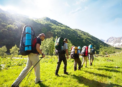
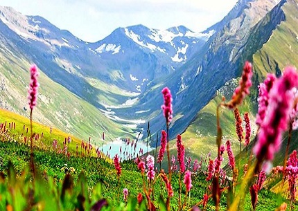
Nag Tibba is trekkers’ delight. A relatively less known trail near Mussoorie, it can easily be considered one of the best treks for nature loving communities. For those who want to walk in the forests, climb up to 10,000 feet, see snow clad mountains and live under starry night skies, the Nag Tibba trek is just perfect.

DEPARTURE/RETURN LOCATION Home / Railway Station / Airport
DEPARTURE TIME Please arrive at least 2 hours before the start Tour.
INCLUDED
Air Ticket Accommodations
Professional guide

1

Day 1:Getting to The Goat Village: Dehradun- Laser Gaon.

Distance: 99 km by road from Dehradun to Laser Gaon
The four hours road journey takes you via Mussoorie, Kempty Falls, over Yamuna Bridge and up to Nainbagh on the road to Purola. From Nainbagh main market, take a road going up on the right side (also known as Nag Tibba road). From here, after a 22 km drive you reach Laser Village via Pantwari which will be start point for the trek to The Goat Village.

2

Day 2 :

At leisure at The Goat Village. Cook, eat the indigenous Garhwali stuff, milk the goats, read, get your hands dirty in the farming or simply do nothing and chill. The accommodation here is a mix of 10 old styled architectural cottages and condominiums and can accommodate up to 30-35 people.

3

Day 3 : The Goat Village to Nag Tibba Summit (9915 ft) via Nag-Tibba Base (8530 ft).

Distance: 4 Km to summit ▪ Time: Around 3 hours to summit, plus 2 hours descent, depening up on one’s fitness level.
The route is mostly a gradual walk with a small section of steep ascent for 10 minutes in between. Nag Tibba Base is a large clearing with a temple dedicated to the Serpent God. You get a view of the Garhwal peaks through the forest. There are 4 steep climbs while trekking in the forest. It can take anywhere between 1 to 1 hour 15 minutes to reach the summit. The summit is straight up and does not require you to go left or right. As you reach the top, you will see the trail re-appear and curve towards a ridge on the left. Walk for a minute till you see an open patch of land sloping downwards on the other side of the mountain. Look for a flag on the highest point called Nag Tibba “Jhandi” or summit. Looking down towards the other side of the ridge you will see the route from Deolsari or Devalsari village.
On the left hand slope from the summit one can get a terrific view of the Himalayan ranges of Swargrohini, Bandarpoonch, Kala Nag, Srikanta, and Gangotri.